
UK Demographic Mapping Data
UPATED WITH 2021 CENSUS DATA
Comprehensive Postcode Sector Insights
UK Demographic Mapping Data
Unlock valuable insights into the UK population with our detailed Demographic Mapping Data, covering over 8,900 postcode sectors across England, Scotland, and Wales. Perfect for businesses, researchers, and analysts, our dataset provides more than 80 demographic variables per sector—empowering you to make informed decisions and strategic plans.
Extensive Coverage: Includes all postcode sectors in England, Scotland, and Wales—over 9,200 in total.
Rich Demographic Variables: Access 80+ data points for each sector, including population estimates, household details, property types, employment status, and more.
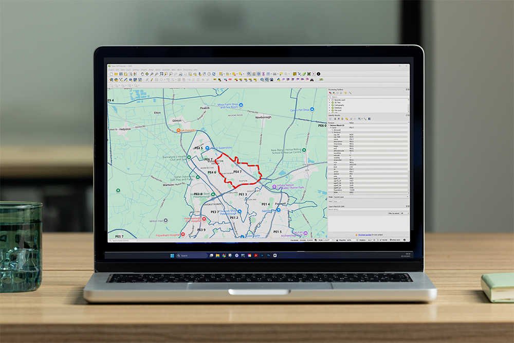
Seamless Integration: Easily import our data into leading GIS platforms, such as QGIS, ArcGIS, Geoplan Skin, and others.
Flexible Formats: Standard delivery in ESRI Shapefile (.shp, .dbf, .shx) format; additional formats available upon request to suit your project needs.
Rapid Delivery: Receive your data set within 12 hours of purchase, ensuring you can start your analysis without delay.
What’s Included in Our UK Demographic Data?
Our comprehensive database provides a wide range of demographic and socio-economic variables for each postcode sector, including:
Pinpoint Your Perfect Audience
Bulk Purchase reports from as little as £10 per report
Now you can access our powerful drive time, area, and distance demographic reports for as little as £10 each with our new bulk purchase options. Our simple credit system allows you to pre-purchase report credits at a significant discount. Once in your account, these credits are valid for 24 months, letting you quickly order future reports with an easy, online request.
Simply use your credits as needed for any report, making sophisticated demographic analysis both affordable and effortless for your ongoing projects.